We are happy to introduce our first in-house developed program to the world: FOSS Post Collapse Monitor.
There are many indicators for a possible collapse in human civilization, motivated by climate change and other elements. Many people started carefully monitoring these elements in order remain alerted as much as possible, and make sure they are prepared for what is to come.
One can find many useful interactive maps online which provide alerts about possible hazards, accidents and natural disasters, but you don’t always want to open them manually each time you want to check them. Additionally, you may want to keep your markings/edits on some of them (Which may support that unlike the others), and hence, putting all these maps in a different standalone window would give the best experience.
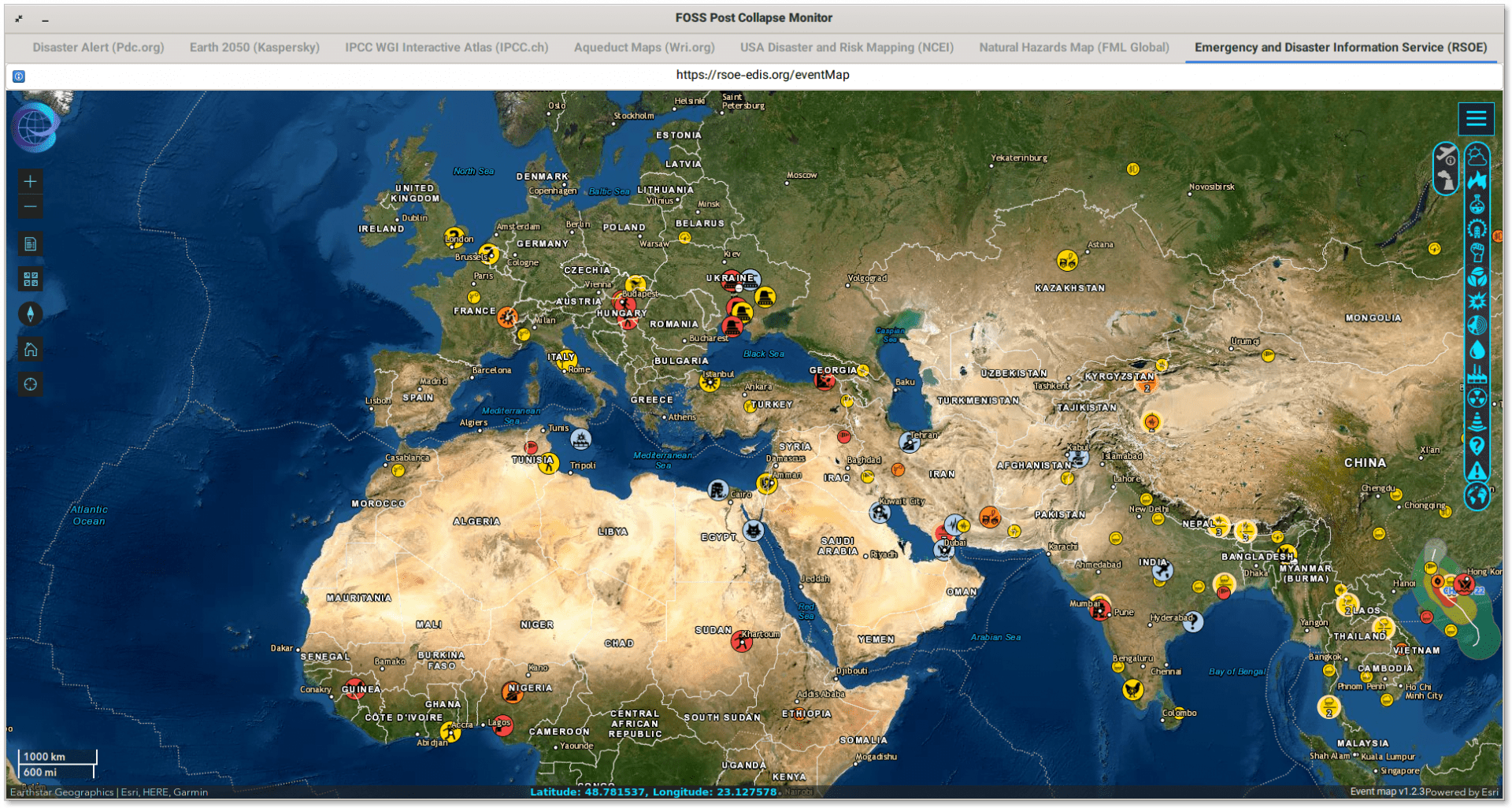
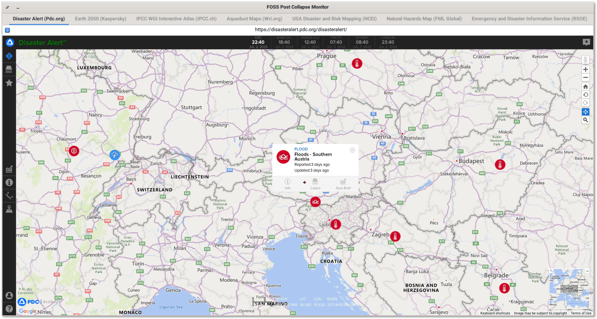
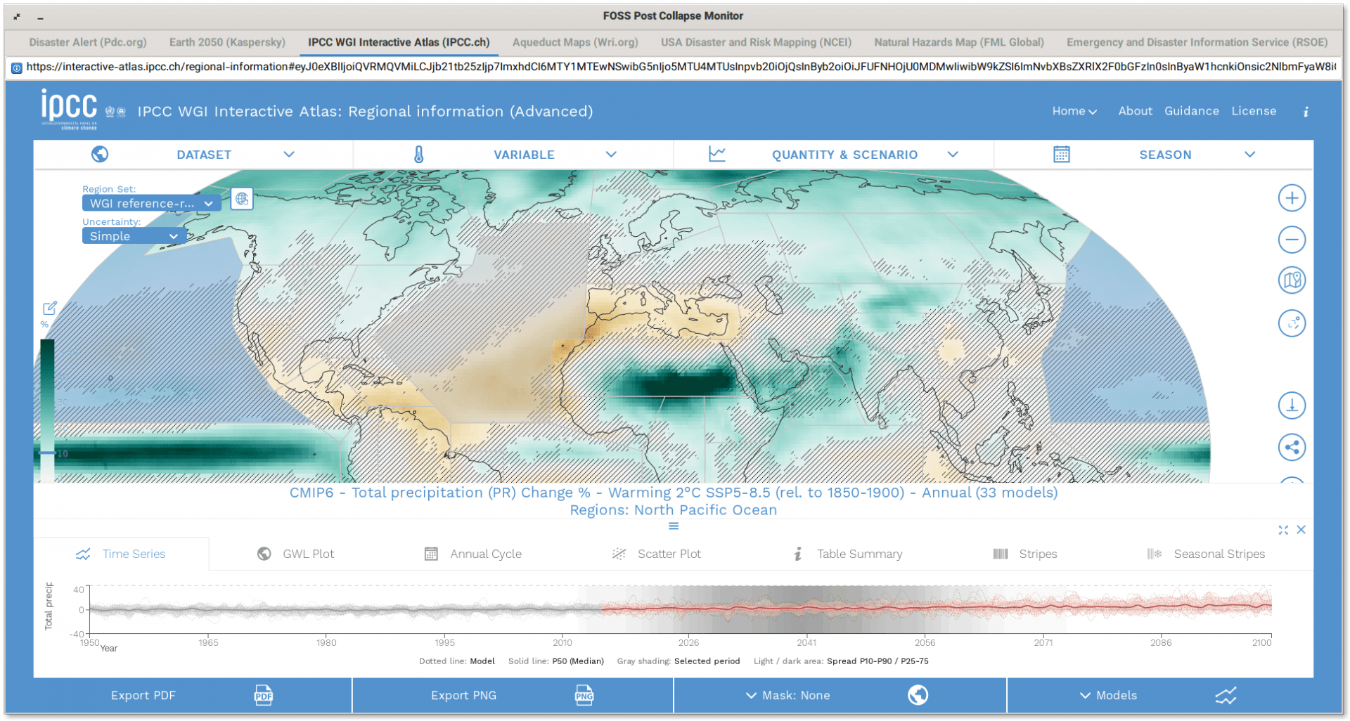
This is the idea of this small app; it is a web browser with 7 maps (Currently) which show different hazards alerts, disaster alerts, future projections for areas with high probability of floodings, earthquakes, natural disasters and many other interesting data.
Table of Contents:
Screenshots
Included Maps
The following maps are included:
- Emergency and Disaster Information Service (RSOE): https://rsoe-edis.org/eventMap
- Natural Hazards Map (FML Global): https://www.fmglobal.com/research-and-resources/nathaz-toolkit/flood-map
- Disaster Alert (Pdc.org): https://disasteralert.pdc.org/disasteralert
- USA Disaster and Risk Mapping (NCEI): https://www.ncei.noaa.gov/access/billions/mapping
- Aqueduct Maps (Wri.org) (Note: We included the URL to the tools page so that you choose the map you want from the 4 maps they offer): https://www.wri.org/aqueduct/tools
- IPCC WGI Interactive Atlas (IPCC.ch): https://interactive-atlas.ipcc.ch/regional-information
- Earth 2050 (Kaspersky): https://2050.earth
If you restart the app, then you will lose your progress (Which is why we have removed the close button, to make it more difficult to close the app), but if you don’t, then you can track the variables/elements that you specify from any of these interactive maps without having to open their websites every time you want to check them.
Installation
The application is quite simple.
For Debian-based and Ubuntu-based distributions, you can download it as a DEB package from the releases page. Then, to install it just run:
sudo dpkg -i replace_with_path_to_deb_file
And you’ll see it in the applications menu so that you can launch it.
For other distributions, make sure that you have the python3, python3-gi, gir1.2-webkit2-4.0 packages installed (Or what corresponds to them on your distribution), and then you can simply run the application with:
python fp-collapse-monitor
Future Updates
If you think that there are some additional maps worth adding, then feel free to leave a comment about them below and we’ll check them up.
This is the first program we release as part of our software collection. It is just a small initiator as they say “to break the ice”, and there will be more useful software from the FOSS Post in the upcoming months.
Feel free to subscribe to our Patreon campaign to support our efforts.
FOSS Post is a high-quality online magazine about Linux and open source software. With a team of professional writers from all over the world, we bring you the latest articles, analysis and reviews related to open source.
Articles published with this account are written as a collaborative effort between writers. You can email us at contact@fosspost.org


